
Filter by
SubjectRequired
LanguageRequired
The language used throughout the course, in both instruction and assessments.
Learning ProductRequired
LevelRequired
DurationRequired
SkillsRequired
SubtitlesRequired
EducatorRequired
Results for "geospatial mapping"

The Pennsylvania State University
Skills you'll gain: Geospatial Mapping, Geographic Information Systems, Systems Thinking, Design Thinking, Geospatial Information and Technology, Spatial Analysis, Community Development, Collaborative Software, Environment and Resource Management, Decision Support Systems, Creativity, Cultural Responsiveness

University of Colorado Boulder
Skills you'll gain: Community Organizing, Compassion, Community Development, Community Outreach, Needs Assessment, Program Evaluation, Empathy, Data Mapping, Teaching, Initiative and Leadership, Empowerment, Curriculum Planning, Working With Children, Collaboration, Student Engagement, Planning, Environmental Issue
University of Illinois Urbana-Champaign
Skills you'll gain: Geospatial Information and Technology, Geographic Information Systems, Apache Hadoop, Spatial Data Analysis, Geospatial Mapping, Spatial Analysis, Big Data, Matplotlib, Data Processing, Computational Thinking, Distributed Computing, Data Manipulation

Universidad Nacional Autónoma de México
Skills you'll gain: Mitigation, Risk Control, Vulnerability, Water Resources, Research, Physical Science, Geographic Information Systems, Environmental Monitoring, Hydraulics, Geospatial Information and Technology
Coursera Project Network
Skills you'll gain: ArcGIS, Data Presentation, Spatial Data Analysis, Geographic Information Systems, Geospatial Information and Technology, Geospatial Mapping, Data Import/Export, Data Mapping, Data Manipulation
 Status: Free Trial
University of Pennsylvania
Skills you'll gain: Health Disparities, Lean Methodologies, Health Care Administration, Health Care, Operational Efficiency, Behavioral Economics, Health Technology, Health Policy, Innovation, Program Evaluation, Process Mapping, Performance Metric, Scientific Methods, Decision Making
 Status: Free Trial
University of Washington
Skills you'll gain: Unsupervised Learning, Bayesian Statistics, Applied Machine Learning, Data Mining, Statistical Machine Learning, Big Data, Statistical Inference, Text Mining, Statistical Modeling, Machine Learning Algorithms, Unstructured Data, Machine Learning, Sampling (Statistics), Scalability, Probability Distribution, Algorithms
 Status: Free Trial
University of Michigan
Skills you'll gain: Application Deployment, Django (Web Framework), Application Development, Web Development, Web Applications, Object-Relational Mapping, Database Design, Data Modeling, Authentications, User Accounts, Relational Databases

École Polytechnique Fédérale de Lausanne
Skills you'll gain: Spatial Data Analysis, Geospatial Mapping, Geospatial Information and Technology, Geographic Information Systems, Spatial Analysis, GIS Software, Global Positioning Systems, Land Development, 3D Modeling, Survey Creation, Systems Of Measurement
 Status: Free Trial
University of Colorado Boulder
Skills you'll gain: Engineering, Scientific, and Technical Instruments, Data Mapping, Real-Time Operating Systems, Global Positioning Systems, Simulations, Linear Algebra, Performance Tuning, Algorithms, Computer Science, Computer Programming
 Status: Free Trial
University of Illinois Urbana-Champaign
Skills you'll gain: Data Mining, Text Mining, Unstructured Data, Big Data, Data Processing, Exploratory Data Analysis, Data Presentation, Data Visualization Software, Analysis, Technical Writing, Algorithms
 Status: Free Trial
University of Minnesota
Skills you'll gain: Design Thinking, Process Mapping, Kanban Principles, Lean Methodologies, Lean Manufacturing, Agile Software Development, Workflow Management, Business Workflow Analysis, Product Development, Agile Methodology, Lean Six Sigma, Process Improvement, Software Development, Software Development Methodologies, Continuous Improvement Process, Innovation, Product Testing
Searches related to geospatial mapping
In summary, here are 10 of our most popular geospatial mapping courses
- Geodesign: Change Your World: The Pennsylvania State University
- Compassionate Leadership Through Service Learning with Jane Goodall and Roots & Shoots: University of Colorado Boulder
- Getting Started with CyberGIS: University of Illinois Urbana-Champaign
- Evaluación de peligros y riesgos por fenómenos naturales: Universidad Nacional Autónoma de México
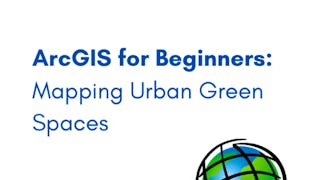
- ArcGIS for Beginners: Mapping Urban Green Spaces: Coursera Project Network
- Health Care Innovation: University of Pennsylvania
- Machine Learning: Clustering & Retrieval: University of Washington
- Django Features and Libraries: University of Michigan
- Éléments de Géomatique: École Polytechnique Fédérale de Lausanne
- Robotic Mapping and Trajectory Generation: University of Colorado Boulder


