
Filter by
SubjectRequired
LanguageRequired
The language used throughout the course, in both instruction and assessments.
Learning ProductRequired
LevelRequired
DurationRequired
SkillsRequired
SubtitlesRequired
EducatorRequired
Explore the Geospatial Course Catalog
 Status: Free Trial
University of Michigan
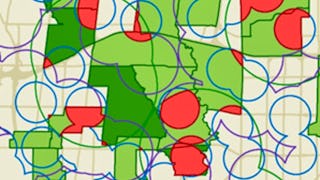
Skills you'll gain: Geographic Information Systems, Geospatial Mapping, Spatial Data Analysis, Datamaps, Spatial Analysis, Data Storytelling, Environmental Monitoring, Heat Maps, Forecasting, Trend Analysis
 Status: Free Trial
Universidad Nacional Autónoma de México
Skills you'll gain: Android Development, Android Studio, Mobile Development, Java, Mockups, Object Oriented Programming (OOP), Application Deployment, Android (Operating System), Java Programming, Application Development, Software Design Patterns, Prototyping, Cloud Applications, JSON, User Interface and User Experience (UI/UX) Design, Program Development, Restful API, User Interface (UI) Design, Web Services, Geospatial Information and Technology
 Status: Free Trial
University of Michigan
Skills you'll gain: Social Justice, Geographic Information Systems, Organizational Change, Environmental Policy, Sustainability Reporting, Environmental Issue, Environmental Regulations, Geospatial Mapping, Culture Transformation, Spatial Data Analysis, Datamaps, Environmental Social And Corporate Governance (ESG), Strategic Leadership, Organizational Strategy, Corporate Sustainability, Spatial Analysis, Organizational Leadership, Systems Thinking, Health Equity, Environmental Laws
 Status: Free Trial
University of Toronto
Skills you'll gain: Spatial Analysis, Geographic Information Systems, Geospatial Mapping, ArcGIS, Data Visualization, Data Compilation, Data Mapping, Data Storytelling, Metadata Management, Data Integration, Data Management
 Status: Free Trial
DeepLearning.AI
Skills you'll gain: Disaster Recovery, Image Analysis, Data Ethics, Emergency Response, Mitigation, Text Mining, Natural Language Processing, Unstructured Data, Artificial Intelligence, Applied Machine Learning, Computer Vision, Geospatial Information and Technology, Machine Learning Methods, Data Analysis
 Status: Free Trial
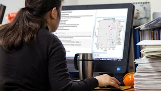
Skills you'll gain: Interactive Data Visualization, Data Import/Export, Technical Communication, Data Analysis, Exploratory Data Analysis, Data Visualization Software, Data Science, Matlab, Statistical Analysis, Probability & Statistics, Descriptive Statistics, Data Manipulation, Data Mapping, Scripting
 Status: Free Trial
Skills you'll gain: Computer Vision, Image Analysis, Deep Learning, Matlab, Applied Machine Learning, Machine Learning, Motion Graphics, Data Mapping, Artificial Intelligence and Machine Learning (AI/ML), Visualization (Computer Graphics), Geospatial Information and Technology, Feature Engineering, Medical Imaging, Machine Learning Algorithms, Data Validation, Geometric Dimensioning And Tolerancing, Performance Testing, Algorithms
 Status: Free Trial
Skills you'll gain: SAS (Software), Forecasting, Spatial Data Analysis, Data Visualization Software, Time Series Analysis and Forecasting, Data-Driven Decision-Making, Predictive Analytics, Geospatial Mapping, Data Analysis, Geographic Information Systems, Data Manipulation, Data Transformation

Skills you'll gain: Spatial Data Analysis, Geographic Information Systems, Geospatial Information and Technology, Geospatial Mapping, Data Analysis, Big Data, Data Visualization, Analytics, Google Cloud Platform, Cloud Management, Data Access, Query Languages
 Status: Free Trial
Universidad de los Andes
Skills you'll gain: Spatial Analysis, NoSQL, Spatial Data Analysis, Geospatial Mapping, Geographic Information Systems, Big Data, MongoDB, File Systems, Apache Hadoop, Distributed Computing, Data Architecture, Database Systems, Cloud Computing, Apache Spark, Public Cloud, Data Processing, Scalability, Databases, Environmental Monitoring, Image Analysis

University of Illinois Urbana-Champaign
Skills you'll gain: Energy and Utilities, Environmental Issue, Geospatial Information and Technology, Environmental Science, Geographic Information Systems, Natural Resource Management, Physical Science, Environment, Risk Control
 Status: Free Trial
University of California, Irvine
Skills you'll gain: Data Storytelling, Dashboard, Data Presentation, Data Visualization Software, Interactive Data Visualization, Statistical Visualization, Plot (Graphics), Tableau Software, Data Ethics, Exploratory Data Analysis, Scatter Plots, Descriptive Statistics, Heat Maps, Data Analysis, Descriptive Analytics, Geospatial Information and Technology, Histogram, Analytical Skills, Application Deployment, Network Analysis
In summary, here are 10 of our most popular geospatial courses
- GIS: Geographic Information Systems for Sustainability: University of Michigan
- Desarrollo de aplicaciones móviles con Android: Universidad Nacional Autónoma de México
- Green Skills for a Sustainable and Just Future: University of Michigan
- GIS, Mapping, and Spatial Analysis Capstone: University of Toronto
- AI and Disaster Management: DeepLearning.AI
- Exploratory Data Analysis with MATLAB: MathWorks
- Computer Vision for Engineering and Science: MathWorks
- Using Data for Geographic Mapping and Forecasting in SAS Visual Analytics: SAS
- Getting Started with BigQuery GIS for Data Analysts: Google Cloud
- Plataformas para procesar datos no tradicionales: Universidad de los Andes


