
Filter by
SubjectRequired
LanguageRequired
The language used throughout the course, in both instruction and assessments.
Learning ProductRequired
LevelRequired
DurationRequired
SkillsRequired
SubtitlesRequired
EducatorRequired
Explore the Geospatial Course Catalog

École Polytechnique Fédérale de Lausanne
Skills you'll gain: Geographic Information Systems, GIS Software, Spatial Data Analysis, Spatial Analysis, NoSQL, Data Modeling, Global Positioning Systems, Databases, SQL, Data Storage, Relational Databases
 Status: Free Trial
University of Toronto
Skills you'll gain: Geographic Information Systems, GIS Software, Spatial Analysis, Spatial Data Analysis, Geospatial Mapping, Query Languages, Data Processing, Data Manipulation, Image Analysis, Data Integration
 Status: Free Trial
Skills you'll gain: Data Storytelling, Data Presentation, Dashboard, Interactive Data Visualization, Data Visualization, Infographics, Data Visualization Software, Business Reporting, Data Ethics, Data-Driven Decision-Making, Generative AI, Web Content Accessibility Guidelines, Artificial Intelligence
University of Illinois Urbana-Champaign
Skills you'll gain: Geospatial Information and Technology, Geographic Information Systems, Apache Hadoop, Spatial Data Analysis, Geospatial Mapping, Spatial Analysis, Big Data, Matplotlib, Data Processing, Computational Thinking, Distributed Computing, Data Manipulation
The Hong Kong University of Science and Technology
Skills you'll gain: Civil Engineering, Structural Analysis, Failure Analysis, Engineering Analysis, Geographic Information Systems, Risk Control, Geospatial Information and Technology, Mechanics, Augmented and Virtual Reality (AR/VR), Experimentation, Laboratory Experience

École Polytechnique Fédérale de Lausanne
Skills you'll gain: GIS Software, Geographic Information Systems, Spatial Data Analysis, Data Modeling, Databases, NoSQL, Data Storage, Data Storage Technologies, Query Languages, SQL, Relational Databases
Coursera Project Network
Skills you'll gain: ArcGIS, Data Presentation, Spatial Data Analysis, Geographic Information Systems, Geospatial Information and Technology, Geospatial Mapping, Data Import/Export, Data Mapping, Data Manipulation

The Pennsylvania State University
Skills you'll gain: Geospatial Mapping, Geographic Information Systems, Systems Thinking, Design Thinking, Geospatial Information and Technology, Spatial Analysis, Community Development, Collaborative Software, Environment and Resource Management, Decision Support Systems, Creativity, Cultural Responsiveness
 Status: Free
École normale supérieure
Skills you'll gain: Infographics, Geospatial Mapping, Geographic Information Systems, Graphic and Visual Design, Data Mapping, Graphics Software, Color Theory, Design Elements And Principles

Universitat de Barcelona
Skills you'll gain: Physical Science, Water Resources, Geographic Information Systems, Geospatial Information and Technology, Chemistry, Environment, Environmental Science, Physics, Biology, Remote Access Systems
University of Illinois Urbana-Champaign
Skills you'll gain: Data Literacy, Data Storytelling, Scientific Visualization, Visualization (Computer Graphics), Data Presentation, Data Visualization Software, Spatial Data Analysis, Computer Graphics, 3D Modeling, Video Production
 Status: Free
Coursera Project Network
Skills you'll gain: HubSpot CRM, Team Building, Customer Relationship Management (CRM) Software, Business Reporting, Marketing Automation, Email Marketing, Sales Development, Customer Data Management, Integrated Marketing Communications, Marketing
In summary, here are 10 of our most popular geospatial courses
- Geographical Information Systems - Part 1: École Polytechnique Fédérale de Lausanne
- Spatial Analysis and Satellite Imagery in a GIS: University of Toronto
- Data Visualization and Reporting with Generative AI: Microsoft
- Getting Started with CyberGIS: University of Illinois Urbana-Champaign
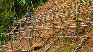
- Slope Engineering: The Hong Kong University of Science and Technology
- Systèmes d’Information Géographique - Partie 1: École Polytechnique Fédérale de Lausanne
- ArcGIS for Beginners: Mapping Urban Green Spaces: Coursera Project Network
- Geodesign: Change Your World: The Pennsylvania State University
- Cartographie thématique: École normale supérieure
- Oceanography: a key to better understand our world: Universitat de Barcelona


